My Journey
I have spent my career following spectra, from the faint signatures of hydrated minerals on Mars to the complex signals captured by advanced imaging systems here on Earth. My path began at Wesleyan University, where I transitioned from a broad interdisciplinary approach to the focused, discipline-specific demands of science instruction. That adjustment quickly evolved into opportunity, and by the end of my sophomore year I had earned the NASA Connecticut Space Grant Scholarship to analyze near-infrared images from the Mars Reconnaissance Orbiter and identify hydrated minerals associated with Martian gullies.
This early work combined geology, chemistry, electronics, and instrumentation, and gave me hands-on training in analytical laboratory techniques, scientific methodology, and data organization. Over the next two years, I processed and analyzed spectral images with ENVI software, presented at national and international conferences, and published research through the Keck Northeast Astronomy Consortium. I also branched into terrestrial remote sensing, mapping plant health in Puerto Rico’s serpentine and non-serpentine soils using NDVI from Landsat imagery, correlating results with climate and elevation data. Through the Ronald E. McNair Post-baccalaureate Achievement Program, I expanded these skills in planetary science data science, classification taxonomies, and content-based image retrieval.

Source: Wesleyan University
I earned my Master’s degree in Applied Geographic Information Systems at Sam Houston State University, building deep expertise in GIS, remote sensing, spatial databases, programming, and advanced spatial analysis. My graduate work emphasized the full geospatial data lifecycle, from acquisition and preprocessing to automation, custom tool development, visualization, and quality assurance. I applied these skills across multiple industries, including environmental monitoring, energy, public health, and national security.
Professionally, my roles have spanned government, defense, and research organizations. At TranSystems, I integrated CAD and GIS datasets for transportation and civil engineering projects, ensuring spatial accuracy and compliance with industry standards. As an Atmospheric Data Scientist Intern at NASA Langley Research Center, I developed Python tools to convert and visualize CALIPSO satellite HDF data for ArcGIS, enabling 3D web-based tracking of polar stratospheric clouds. I later joined NASA Langley’s Space Mission Analysis Branch to design spatial decision support systems for human landing site planning on Mars, integrating terrain, subsurface, and environmental datasets for operational and scientific decision-making.
In 2016, I have served as a Planetary GIS Consultant at NASA Langley, developing custom geospatial tools for Mars exploration zone planning and supporting multidisciplinary teams of scientists and engineers. My work has included hazard mapping, terrain modeling, and integrating orbital and in situ datasets for mission planning. At the Army Geospatial Center, I managed vector data production to Department of Defense standards, ensuring interoperability, precision, and readiness for mission rehearsal and tactical planning.


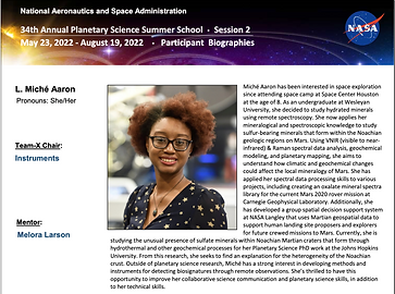
At the Carnegie Institution for Science, I developed a Raman spectral library of oxalate minerals for the Mars 2020 rover, integrating CRISM orbital data with laboratory spectroscopy to investigate organic–mineral reactions. I have led instrument definition and reconnaissance planning for simulated planetary missions, developing observation strategies, resolution calculations, and hazard assessments to ensure mission success.
In 2022, I served as Instruments Chair and Reconnaissance Co-Lead for a sample return mission we designed called GELATO at the NASA Jet Propulsion Laboratory’s Planetary Science Summer School program. In this role, I led the definition of payload instrument requirements for both a hyperspectral imager and a multi-color camera, aligning spatial resolution, spectral range, and signal-to-noise ratio targets with the mission’s science traceability matrix. I established observation strategies for each orbital phase, developed a full reconnaissance campaign, sequenced high- and low-altitude mapping orbits, integrated hazard analysis for safe sampling site access, and calculated resolution requirements down to 1 cm/pixel for TAGSAM feasibility. This work balanced broad mapping with targeted site characterization, integrated thermal and lighting constraints, and ensured that science priorities aligned with engineering and operational realities.

Today, as I complete my Ph.D. in Earth & Planetary Science at Johns Hopkins University, I focus on hyperspectral remote sensing, spectroscopy, and geochemical modeling. My work integrates orbital datasets, laboratory synthesis experiments, and geochemical simulations to detect hydrated sulfates, reconstruct ancient aqueous environments, and inform mission targeting strategies. By harmonizing data from multiple sources, I aim to reduce uncertainty, identify robust mineralogical signatures, and translate scientific insights into operationally relevant solutions.
I am committed to bridging the gap between research and operations. Whether leading a reconnaissance planning team, producing mission-critical datasets, or mentoring future scientists, I strive to connect disciplines, adapt tools across domains, and ensure that advanced imaging science drives meaningful outcomes in planetary exploration, environmental monitoring, and defense applications.

